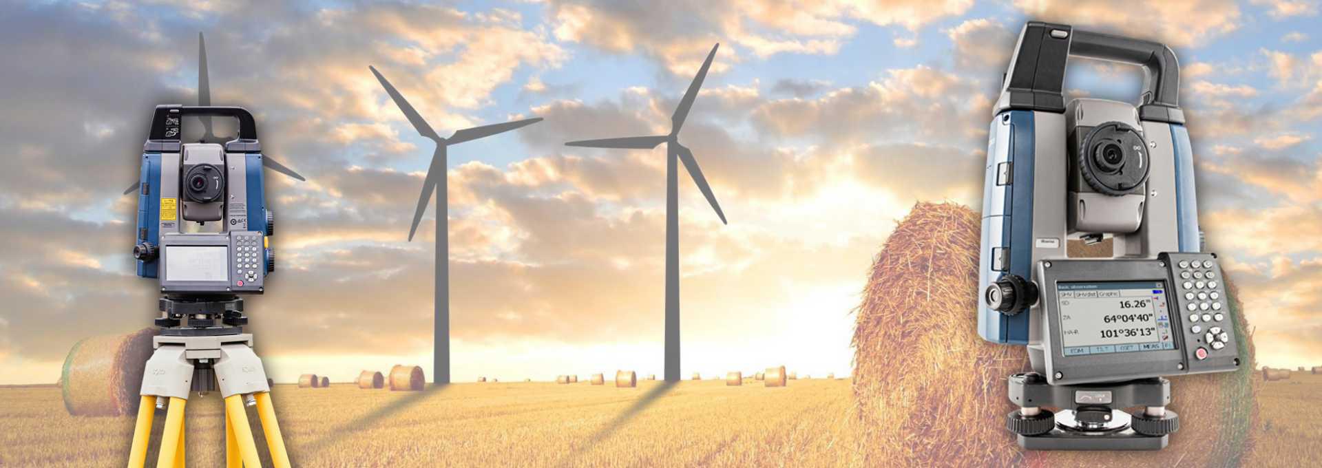
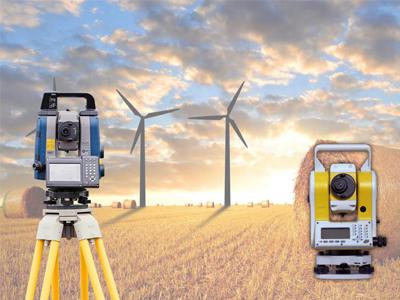
Sokkia and Hi-target Brand:
If you’re shopping for the best surveying instruments such as Auto Levels, Total Stations, RTK GNSS GPS, Laser Distance Meter, Theodolite.
When your project demands high-quality land surveying instruments and tools, we have the top brands of commercial grade surveying instruments that will stand up to the job.
We carry a wide variety of commercial-grade surveying tools, including land surveying tripods, planimeters, auto levels, abney levels, ranging rods, surveying prisms, surveying prism poles, total stations, RTK GNSS GPS equipment, bags and cases, theodolites, change plates,becon plates, tribrachs and land surveying equipment adapters.
When it comes to surveyors tools, we have you covered. If you have a question about any of the products we sell, please don’t hesitate to contact us.
We provide full service and calibration on all brands of Auto levels, Theodolites, Totalstations.
Sokkia Positioning Sales is a wholly owned subsidiary of Topcon Holdings. It serves as a dynamic distribution center, ensuring Sokkia products are supplied and supported in accordance with the parent company’s high standards.
Sokkia Positioning has capable and reliable distributors, agents and dealers throughout these regions providing full sales, service and technical support. Authorized service centers are equipped with state of the art facilities and are managed by factory trained technicians.
Sokkia specializes in Auto Levels, Digital Levels, GRX3 GNSS RTK Receiver, GCX2 Network GPS Receiver. Total Stations such as the FX Series, IM 50 Series and the IX Series.
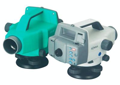
Sokkia – B30/B40 Auto Levels:
- Enhanced reliability under all environmental conditions.
- Tough and compact bodies sealed against water, humidity and dust.
- Quick setup, easy sighting and superior durability against shock and vibration.
- Stadia lines on the reticle allow distance measurements.
Click on the PDF icon
to view brochure!


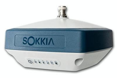
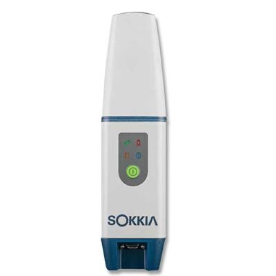
Sokkia – GCX2 Network GPS Receiver:
-
Dual frequency and multi-constellation GNSS RTK receiver
-
Compact, lightweight, rugged, and cable-free design
-
Wireless multi-channel long-range Bluetooth technology RTK corrections
-
Simplified user display
-
Precision orbital satellite technology (POST) integrated antenna
-
226 Channels with optimized satellite tracking technology
Click on the PDF icon
to view brochure!
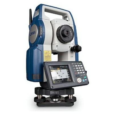
Sokkia Total Stations – FX Series:
- 2,000 m reflectorless measurement
- Long-range Bluetooth technology
- Advanced angle measurement system
- Rugged and operator friendly
- Advanced security with TSshield™
- Waterproof IP66
Click on the PDF icon
to view brochure!
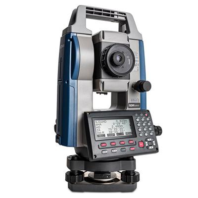
Sokkia Total Stations – IM 50 Series:
- RED-tech Technology Reflectorless EDM
- LongRange Data Communication*
- Advanced Angle Measurement System
- Long-lasting Battery
- Waterproof, Rugged, and Operator Friendly Design
- USB downloading
Click on the PDF icon
to view brochure!
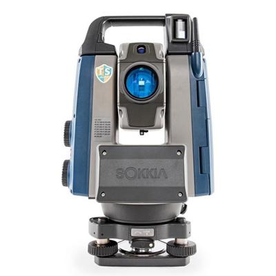
Sokkia Total Stations – IX Series:
- Superior Auto-Pointing Technology
- Advanced Angle Measurement System
- RED-tech Technology Reflectorless EDM
- LongRange Data Communication
- Dust and Water Protection IP65
- MAGNET™ Field On-Board Application Software
Click on the PDF icon
to view brochure!
Established in 1999, Hi-Target Survey Instruments Company Ltd engaging in GNSS high-tech technology industry, covering from GNSS technology development, to production as well as marketing and sales. In China, Hi-Target has established a nationwide sales and service network with 30 branches, 7 technical service centers.
Hi-Target has 4 core businesses involved in surveying GNSS product series, digital sounder series, GIS data acquisition system, marine engineering application integrated system, marine surveying, and marine mapping software products.
Hi-Target have more than 1000 employees, they are long-term commit GNSS technology research and development, production, marketing services and involved in the development of the whole process of localization of GNSS.
We stock a wide variety of HiTarget products: V90 Plus GNSS RTK System, QMINI A7 High Precision GIS Handheld, QPAD X5 GIS High Precision Rugged Tablet and the ZTS-360/R Totals Stations.
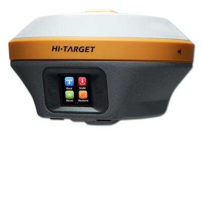
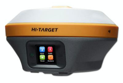
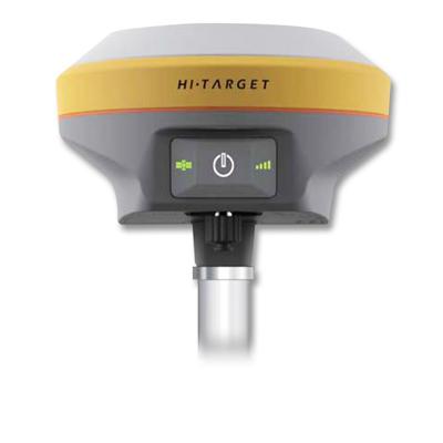
Hi-Target – V90 Plus GNSS RTK System:
- Multi-constellation tracking
- Smart application
- Optional transceiver UHF radio
- Multi network connection
- Powerful high-capacity (5000mAh) Li-ion battery
- Rugged design – IP67 dustproof and waterproof
Click on the PDF icon
to view brochure!
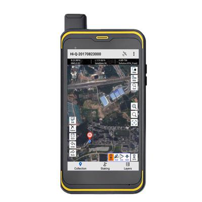
Hi-Target – QMINI A7 High Precision GIS Handheld
-
Android 6.0 OS 2.0GHz 8 core high speed processor.
-
Professional RTK engine.
-
An open platform for 3rd party software.
-
5500mAh battery providing up to 12 hours continuous operation.
-
Protection for 1.5m drop to ground to IP67 standards.
Click on the PDF icon
to view brochure!
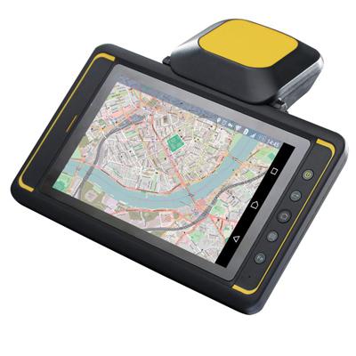
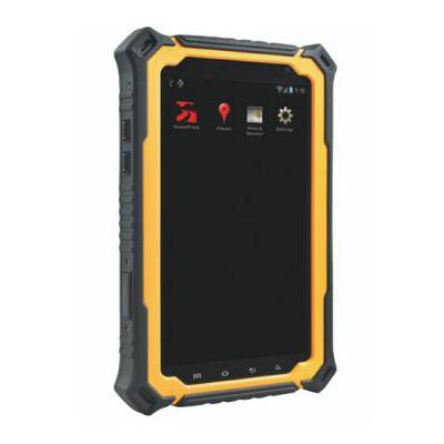
Hi-Target – QPAD X5 GIS High Precision Rugged Tablet:
-
High-accuracy GNSS module realize RTK performance
-
Industry rugged design for fieldwork
-
High performance tablet computer
-
Professional mobile GIS software and application solution
Click on the PDF icon
to view brochure!
Hi-Target – ZTS-360/R Total Station:
- Compact, lightweight design
- Quick trigger button
- Powerful and fast EDM capability
- Stable dual-axis compensation
- Upward laser pointing
- Intelligent calibration software
Click on the PDF icon
to view brochure!
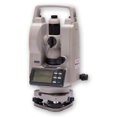
Protsurv International offers the customer a choice of two Fuyiyama Theodolite and Auto Levels, they both offer you great value for money, in all weather conditions, no matter where you are, the FYT 2 Electronic Theodolite and the FYMD32 Auto Levels. These surveying instruments are suited for professional surveyors and construction engineers.
The FYT-S2 Theodolite and the FYMD32 Auto Levels guarantees reliability, ease of use and ruggedness in mind and carries a full one-year guarantee. After sales support is provided by our factory trained technicians operating from our fully equipped workshop in Kempton Park.
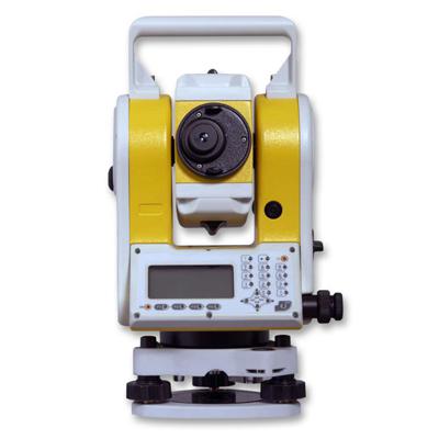
Fujiyama – FYT 2 Electronic Theodolite:
- 30x Magnification
- 1˚30˝ Angle of view
- 45mm Objective aperture
- 1.3m Shortest view distance erect image
- 1D30˝ Field of view
- 100 Stadia ratio
- Standard with rechargeable batteries, can be operated with AA
- Resolving power of 3.5 ˝2.5” for fyt 20”
Click on the PDF icon
to view brochure!
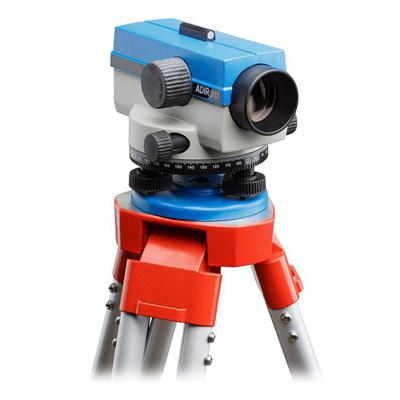
Fujiyama – FYMD32 Auto Level Specifications:
- Enhanced reliability under all environmental conditions
- Tough and compact bodies sealed against water, humidity and dust
- Quick setup, easy sighting and superior durability against shock and vibration
- Stadia lines on the reticle allow distance measurement
Click on the PDF icon
to view brochure!
Duosoft Leveling Software:
-
Normal – Does your basic BS/FS levelling and infield reductions.
-
Profiles – Places your nails on the profile poles using chainage and offset.
-
As Build – Captures and calculate your as build for the required layer
-
It can be exported in a .xx1 or .csv format with the calculations already done.
Click on the PDF icon
to view brochure!
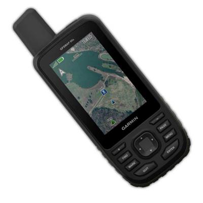
Garmin – Premium handheld GPS:
- Large, 3” sunlight-readable color display for easy viewing
- Multiple Global Navigation Satellite Systems (GNSS) support to track your travels in more challenging environments than GPS alone plus three-axis compass and barometric altimeter
- Access to BirdsEye Satellite Imagery with direct-to-device downloads and no annual subscription
- Expanded wireless connectivity supports Active Weather for up-to-date forecasts and animated weather radar and Geocaching Live for mobile syncing and updates
- Compatible with Garmin Explore™ website and app to help you manage tracks, routes and waypoints and review statistics from the field
- Up to 16 hours of battery life in GPS mode; 1 week in expedition mode lets you explore longer than ever before on a single set of AA batteries
Click on the PDF icon
to view brochure!
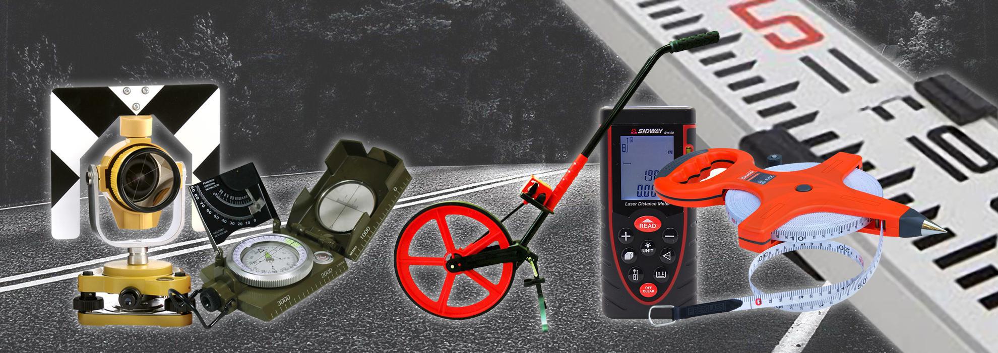
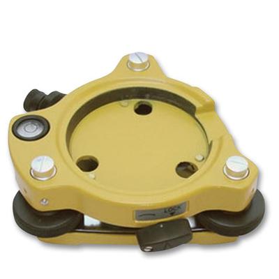
Tribrach with Optical Plummet
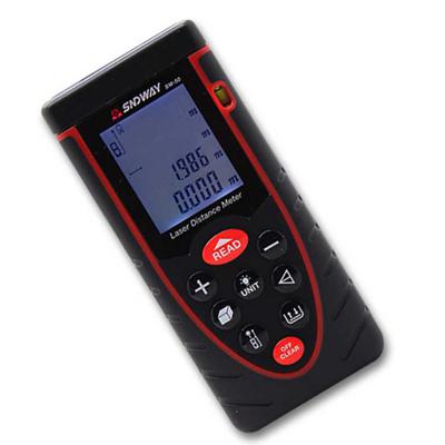
Laser Distance Meter
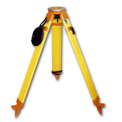
Surveying Tripods
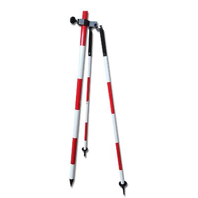
Surveying Supports
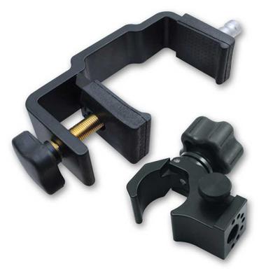
Clamps and Cradles
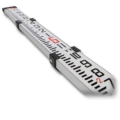
Surveying Staff
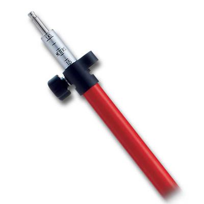
Surveying Poles
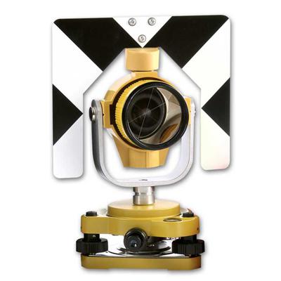
Surveying Prism’s
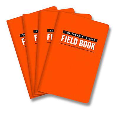
Surveyor Field Books
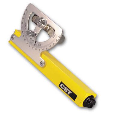
Abney Levels
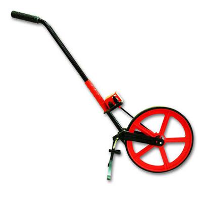
Distance Measuring Wheels
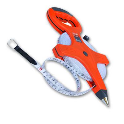
Measuring Tapes
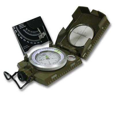
Compasses & Clinometers
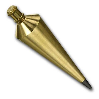
Plumb Bobs
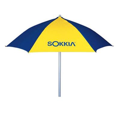
Survey Umbrellas